July 8, 2026 | Utah, United States
A massive wildfire burning in southern Utah has become one of the largest and most destructive wildfires in the United States this year, as firefighters continue battling flames fueled by extreme heat, dry vegetation, and strong winds.
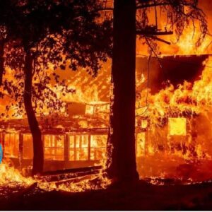
The Cottonwood Fire, located near the Beaver River in Beaver County, has burned approximately 150 square miles (390 square kilometers) as of July 7, 2026. The fire has destroyed up to 150 structures, including more than 100 condominiums and 30 cabins at Eagle Point Ski Resort, according to state officials.
More than 1,280 firefighters have been deployed to contain the blaze. Fire crews had achieved 56% containment by July 7, but officials warned that hot, dry weather and gusty winds could cause the fire to spread rapidly over the coming days.
NASA satellite imagery captured by Landsat 9 shows the dramatic transformation of the landscape before and after the wildfire. Data from NASA’s Fire Events Data Suite (FEDS) revealed that the fire expanded especially quickly on June 23 and June 26, with one surge tripling the fire’s size in just 12 hours.
The wildfire has burned through forests of ponderosa pine, oak, sagebrush, and grasslands, leaving vast areas blackened. However, some forest sections near Tushar Campground survived largely intact. Local officials credited years of forest management, including brush clearing and tree trimming, for helping protect the campground and surrounding woodland.
The National Interagency Fire Center had warned before July that below-average winter snowfall and an unusually warm, dry start to summer would create ideal conditions for severe wildfires across the Great Basin and parts of the Rocky Mountains. Those warnings have since become reality, with dozens of major wildfires burning across the western United States.
According to the National Interagency Fire Center, wildfires had burned 5,265 square miles (13,636 square kilometers) across the United States by July 7, 2026—about 46% above the 10-year average for the same point in the fire season.
Authorities continue urging residents in affected areas to follow evacuation orders and monitor official updates as dangerous fire conditions persist.
Sources:
- NASA Earth Observatory
- National Interagency Fire Center (NIFC)
- InciWeb – Incident Information System
- Utah Division of Forestry, Fire and State Lands